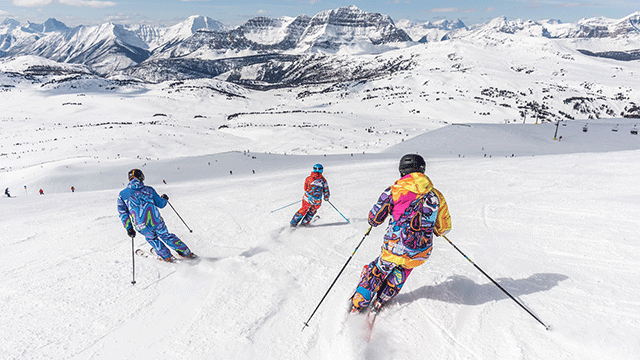
| Across the Nullarbor - Quick Facts | |
| Tourist Information | |
| Norseman to Balladonia (193km) |
| Balladonia to Caiguna (182km) |
| Caiguna to Madura (157km) |
| Madura to WA/SA Border Village (194km) |
| WA/SA Border Village to Nullarbor Roadhouse (185km) |
| Nullarbor Roadhouse to Nundroo (145km) |
| Nundroo to Ceduna (153km) |
The road is wide and sealed from beginning to end with plenty of good rest areas along the way so you can stop, revive, survive. Many dismiss the route as being tedious to the extreme but frankly, it can be a great adventure and a highlight of any journey - it's simply a state of mind and all to do with how you approach it!
The longest stretches between fuel stops are from Norseman to Balladonia (193km), Balladonia to Caiguna (182km) and from the WA/SA border to Nullarbor Roadhouse (185km); otherwise, roadhouses and emergency telephones are dotted at fairly regular intervals along the route. Signs will tell you how far it is to the next stop, so you'll be able to plan your trip as you go.
You can plan your trip in detail if you go to Nullarbor Net. It's a great site, with details and contact information for every roadhouse and accommodation option in every town on the route, plus lots of interesting stuff on things to see and do along the way.
Some of the biggest hazards that you may face are fatigue and straying stock. Keep to the speed limit, make use of the numerous, well set up rest areas and stay alert. Carry drinking water with you - the tanks along the highway are unreliable and prone to vandalism. Note that the Royal Flying Doctor Service occasionally uses the highway to make a landing - you'll see relevant signs and markings on the bitumen along the "runways". Landings are always heralded by personnel located on the road itself - police, roadhouse staff or others seconded for the purpose - so you'll have plenty of warning of an impending arrival. It's a rare occurrence, but it does happen!
Australian Geographic publishes an excellent book on the area, "The Nullarbor" by Mitch Reardon (1997).
Edward John Eyre was the first European tocross the Nullarbor Plain, back in 1841. He set out from Fowlers Bay in South Australia with an overseer, John Baxter, and a party of three Aboriginal men and although suffering from a lack of water, made it as far as Caiguna before trouble really struck. Two of the Aborigines killed Baxter and made off with the party's supplies, leaving Eyre and the other Aborigine, Wylie, to fend for themselves. Following the Bight westward, the pair managed to survive due to a combination of bushcraft, ingenuity and luck and, after receiving some supplies from a French whaling vessel anchored at Rossiter (not far from Esperance), eventually made it to Albany in 1841.
The need for a communications link across the continent was the impetus for the development of an east-west crossing. In 1877, after two years of labour, the first messages were sent down the new telegraph line, boosted by a series of eight repeater stations along the way. The line was in operation for around 50 years before being superseded; relics of it are still visible. A 'highway' was carved across the continent in 1941; little more than a rough and ready track, it remained that way until concerted efforts by WA and SA saw the entire route sealed during the early 1970s.
The flat expanse of the Nullarbor Plain conceals a network of sinkholes and caves carved from limestone. Some are open to the public BUT you'll need extensive caving experience and a permit from either the CALM or the SA Department for Environment, Heritage and Aboriginal Affairs (DEHAA) to explore them. People have been killed in the Nullarbor caves because they underestimated the levels of skill and care involved in mounting an expedition, so you must consult CALM or DEHAA before venturing near them and abide by any restrictions. Phone CALM Esperance on (08) 9071 3733 or DEHAA Ceduna on (08) 8625 3144.
A mining town set in heavily timbered country, Norseman is the jumping off point for the trip east, or a welcome destination for those who have just travelled from South Australia.
The highway passes through wooded hill country and, about 100km east of Norseman, climbs the Fraser Range. Fifty kilometres further on, you'll get good views of the area from Newman Rocks, about a kilometre away to the left and signposted. This is a water catchment area and well known picnic spot; it's also roughly where you'll cross a time zone - if heading east, turn your watches and clocks forward by 45 minutes.
Balladonia is on your left and provides all the usual roadhouse facilities as well as accommodation and camp sites. The settlement shot to fame in 1979 when parts of the US Skylab space station plummeted to earth here after disintegrating upon re-entry to the atmosphere.
From Balladonia, a 4WD track leads north to the community of Rawlinna, famous for its muster held in mid-April. Another road heads south to Cape Arid National Park. It's poorly maintained and generally not suitable for conventional vehicles. Check at Balladonia before setting out.
Just beyond Balladonia lies a formation known as Afghan Rocks. They form a small water catchment and were named after a camel driver who was shot by thirsty travellers whilst bathing in the only unpolluted pool of water. His grave lies nearby. Beyond this lies old Balladonia Homestead, a lovely stone place built in 1889 and now host to an art gallery depicting the history of the Eyre Highway and the region. Probably the most noteworthy feature of this stretch of the Eyre is the 'Ninety Mile Straight', which starts about 30km south-east of Balladonia and shoots in a straight line all the way to Caiguna. At 146.6km, this is one of the longest straight stretches of road in the world, but don't expect it to be flat - it may be straight, but it's also surprisingly undulating!
Caiguna features a roadhouse, motel and camp sites. Five kilometres west of the settlement on the right is an unusual blowhole and about 20km to the south of that, a memorial cairn to John Baxter, the unfortunate overseer on Eyre's expedition. The cliffs along this part of the Bight are named after him.
From Caiguna, the highway twists and turns through the Nuytsland Nature Reserve to Cocklebiddy. Once an Aboriginal mission, today it offers roadhouse, accommodation and camping facilities. The ruins of an old telegraph station lie nearby. Cocklebiddy is also the access point for exploration of Cocklebiddy Cave, a magnificent place that contains one of the longest underwater passages in the world. A world record was set here in 1995 by Adelaide diver Chris Brown, who managed to reach a depth of 6.25km.
About 17km east of Cocklebiddy is the turnoff to the Eyre Bird Observatory. Situated at the old Eyre telegraph station built in 1879, the observatory offers accommodation (bookings essential) and the chance to see some of the diverse, and in many cases rare, birdlife of the Bight. If you haven't already seen a wedge-tailed eagle along the highway, you will almost certainly see one here! It also houses a small museum and if you have the time, it is worth the trip - you should allow a good day for a return journey from Cocklebiddy. The observatory is accessible via a track that runs for about 32km over the sand dunes. The last 12km are 4WD only; if you don't have a 4WD, phone the observatory on (08) 9039 3450 and arrange to be picked up from a lookout about halfway down the track.
Back on the highway, it's another 74km to Madura, nestled at the foot of Madura Pass. Once again, the usual facilities are on offer here - a roadhouse, accommodation and camping. Old Madura Station, settled in 1876, was where the hardy 'Waler' horses were bred for the Indian Army for many years. The breed was all but wiped out during World War I.
It's a strange feeling to sweep down off the Hampton Tableland at Madura - for the next 200km, you're travelling beside what appears to be a long, low series of hills flanking the highway. Drive to the top of the ridge, however, and all you'll see are flatlands stretching away before you, seemingly forever...
It's 116km of uneventful road to Mundrabilla, the next settlement along the Eyre. Fuel, food and accommodation is available here and there's the added attraction of a small farmyard and playground for children. While you're there, pat the friendly goats and ponies and say hello to Carmel the camel, a gentle beast who 'dances for her dinner'. Her mother was killed on the railway line some time back - baby Carmel was rescued and adopted by the roadhouse, and has since become one of its celebrities. From Mundrabilla, it's 66km to Eucla.
You'll find Eucla at the top of the rise, after you've climbed back on top of the tableland. There are a roadhouse and various accommodation options here, as well as a couple of things to see. The roadhouse features a pretty courtyard garden and a giant fibreglass southern right whale, one of many 'big' things you'll see between here and Ceduna, as well as a small museum. A lookout on top of the escarpment offers superb views over Eucla and the coast.
A track runs from behind the roadhouse towards the Bight and the ruins of an old telegraph station, nestled amongst the Delisser Sandhills at the edge of Eucla National Park. Usually all you'll be able to see is a chimney and little else, but every now and then, the shifting dunes roll away and uncover the whole ruin. You're quite close to the sea here, but take care if you decide to walk down to it - the dunes are dazzling and white and you can easily become disorientated.
Another track heads north from Eucla to the settlement of Forrest on the railway line, passing the track to Weebubbie Cave along the way. Access to this cave is no longer permitted.
Another 12km along the highway will bring you to the border and just across it, the WA/SA Border Village - and another time zone. Facilities include a roadhouse and accommodation, and the place also has a couple of oddities, including a massive signpost to everywhere and Rooey II, a 'big' kangaroo.
This stretch of the new highway travels for the most part through the Nullarbor National Park, along the cliffs of the Bight. Not far east of the border, you'll start to see tracks to your right that are signposted to lookouts - there are five of them in all, spread over a distance of around 85km. They're certainly worth a diversion, even if you can only manage to visit one - together, they're some of the scenic highlights of the trip. You should take care near the lookouts - the limestone cliff tops are unstable here and can pose a danger.
Honestly, nothing can beat the exhilaration of standing here on the edge of the earth where the Bunda Cliffs splay abruptly beneath you
You can really feel the weight of the continent as it rushes to meet the sea. The feeling is probably accentuated by the flatlands of the Nullarbor plain - but it's potent nonetheless.
It's near here, as the highway continues on its course to Nullarbor Roadhouse, that the country takes on the classic 'nullarbor' attributes. Edmund Delisser, a South Australian surveyor, coined the expression 'Nullarbor' in 1866; the word is a corruption of the Latin term 'nullus arbor' meaning 'no tree'. It's an appropriate description - vast treeless, bluebush-studded plains stretch forever in all directions, cut only by the black ribbon of the highway.
The highway merely skirts the true Nullarbor however, passing through a relatively small section of the plain. For a real taste of it, you'll have to head north to the Trans-Australia Railway, which runs roughly parallel with the highway and passes through the heart of the Nullarbor plain. Completed in 1917 after five years of labour, it features the longest straight stretch of railway in the world, clocking in at around 478km. The best access is via the dusty track to Cook, a trip of around 100km one way.
Cook itself is worth a visit if you have the time. There’s only two people who live in here, a lonely ghost town straddling the train tracks in the middle of the Nullarbor, next door to nowhere and no-one. Apart from a twice weekly gaggle of tourists who have rolled off the Indian Pacific to stretch their legs with a few laps of the deserted township, the only people who come to stay are the train drivers.Cook is a driver changeover point on the 4352 km run across Australia.
Back on the Eyre Highway, the Nullarbor Roadhouse will eventually loom on your left. It features all the usual facilities and a concrete whale that welcomes you to the area.
Once beyond Nullarbor, you enter Yalata Aboriginal land. You do not need a permit to travel along the Eyre Highway but if you're venturing off it, you'll need to obtain one from the Yalata Roadhouse.
One of the main reasons for diverting from the highway is whale watching. Every year between May and October, the waters of the Great Australian Bight play host to southern right whales that come to mate and calve around the Head of Bight area. The Head of Bight is accessible via a sealed road that leaves the highway 12km east of Nullarbor and travels 15km down to the shore. It traverses Yalata land and you will need a permit, obtainable from the Yalata Roadhouse or from the ranger station at White Well, 7km south of the highway.
The Yalata Roadhouse can advise as to any whale watching tours that may be operating in season. It's also a good stopping place on the highway, with roadhouse facilities and a collection of Aboriginal arts, crafts and artefacts on display and for sale. From here, it's an uneventful 51km to Nundroo, another roadhouse offering amenities for travellers.
South of Nundroo, a road to the right will take you to the coastal settlement of Fowlers Bay (a popular place with anglers); another road leaves the town to join the highway roughly 40km further down, so you won't have to double back towards Nundroo.
The highway dips and curves towards Penong as you start to journey into more populated country. The little township is known for its windmills and offers plenty of facilities for travellers, as well as the interesting Woolshed Museum with its regional memorabilia and local arts and crafts. Penong is also where you turn off to Cactus Beach, renowned throughout the world for its left and right hand surfing breaks. Although the surrounding land is private property, the owner permits camping in a natural environment, phone (08) 8625 1036 for details.
From Penong to Ceduna, it's an easy run of 73km. Stop off at Denial Bay, south of the highway and about 14km west of Ceduna, for a feast of luscious oysters - this is one of Ceduna's thriving industries and the rationale behind one of the town's major annual events, the Oysterfest held over the October long weekend.
After the long trek from Norseman in Western Australia, Ceduna will probably be a welcome stop for most travellers - and if you're heading west, you have it all to look forward to!
Images courtesy of SA Tourism
For those with a yearning to touch that red heart, there can be few more attractive places than Innamincka, in SA's far north.
If you're not in Coober Pedy looking for opal, then you're probably here to buy some. As it’s the largest opal mining town in the world.
The Nullarbor is legendary and one of Australia's great road journeys, wide and sealed from beginning to end with rest areas.
The Oodnadatta Track passes through a mixture of plains and undulating countryside, skirting the vast expanse of Lake Eyre.

Sign up for the NRMA Travel newsletter