Three dams to visit in NSW

In the November 25, 1928 edition of Open Road, an uncredited writer offered this opinion: “The weekend motorist has not done his job thoroughly if he has not visited the great dams that impound the water with which Sydney quenches its ever-growing thirst these sweltering days.”
With the exception of some new technology and more modern picnic facilities, not a lot has changed in the ensuing 90-plus years – including Sydney’s thirst, which is more unquenchable than ever. Completed between 1907 and 1927, the Cataract, Cordeaux and Avon dams were almost new when Open Road featured its original story. Along with the Nepean Dam (which wasn’t finished until 1933), they’re collectively known as the Upper Nepean System.
Located roughly 40 kilometres south of Sydney, the Cataract, Cordeaux and Avon dams lay nestled between the Princes and Hume highways. Commute time from Sydney is about 90 minutes, while those leaving from Wollongong can reach them within 40-60 minutes or so.
All are listed on the State Heritage Register for their technical and aesthetic significance. Bizarrely, there’s no on-site historical information about the dams for visitors, save for the original commemorative plaques that detail their dimensions and the engineers involved in construction. The unused pylons would be the perfect place for information boards and historic photos, all of which are available on the Water NSW website.
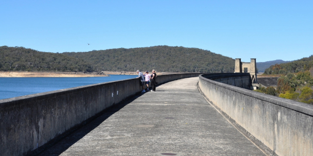
Cataract Dam
Preparations for Cataract Dam (also pictured at top of story) began in 1903 with the clearing of the area to be submerged. The concrete blocks used in its walls were taken from a factory on the banks of nearby Loddon Creek and cement and other construction materials were hauled 28km via steam tractor from Campbelltown.
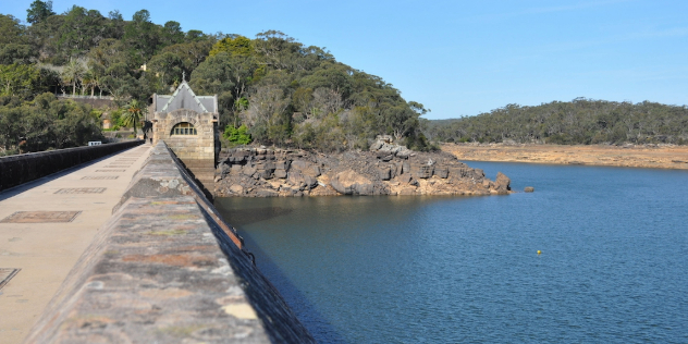
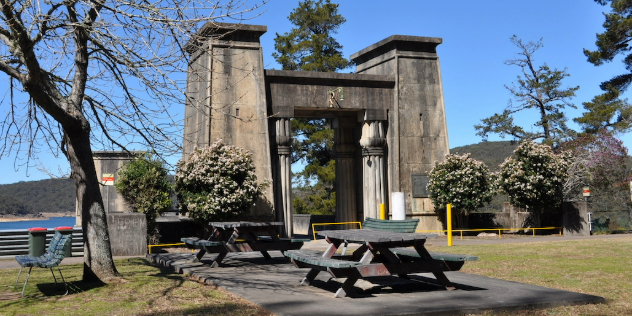
The dam was completed in 1907 and visitors nowadays are greeted with a well-wooded picnic area with many tables, barbecues, two toilet blocks, a kids’ play area and even a running track. A number of historic buildings are dotted around the property: one appears to be a disused cottage and further down the hill is the Grand Homestead, which is now a conference centre and not open to the public. Signs claim there’s a museum, but this also appears to be closed.
The buildings are an inkling of the dam itself and it’s the most ornate of the three. The water side of its wall has battlements, like a castle, and its central gatehouse resembles a sandstone church. The gatehouse’s doors are closed and locked, which is disappointing until we peer through the plate glass windows and see a temporary brace propping up the roof. Just up from the dam entrance is an ornamental bridge over what was once a man-made waterfall, and a plaque memorialising the massacre of 14 indigenous Dharawal people in 1816.
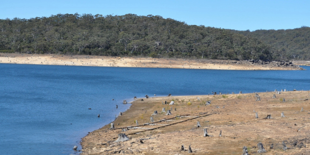
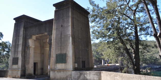
Cordeaux Dam
This dam was scheduled for construction only a few years after Cataract, but, ironically, seven years of heavy rainfall delayed work until 1918. This period marked fervent interest in all things Egyptian, thanks to the work of British archaeologists, and both Cordeaux and Avon’s gateways were inspired by ancient Egyptian architecture. Cement and metal were transported via a 5km steam-operated ropeway across the Nepean Gorge near Douglas Park and then brought to the dam site via narrow-gauge railway, with construction completed in 1926.
Cordeaux Dam features a large car park and expansive picnic grounds with barbecues and play equipment. A sign on the toilet block alleges it has baby change facilities, but the change table is missing when we visit (possibly ripped out of the wall). At the far end of the car park/picnic area is a bushy lookout over Cordeaux Lake. Close by is a small shelter with a plaque showing the dam’s specifications and a period map that indicates the distance of all the Upper Nepean System dams from Sydney.
Down at dam level there are a few more picnic tables and a small park area with palm and pine trees. While Cordeaux has a pretty entranceway, overall it’s the least picturesque of the three dams we visit. Its pylons are a popular nesting site for swallows and thus painted in droppings. The stairway to the vantage point where the 1928 Open Road photo was taken remains but is no longer accessible to the public.
Avon Dam
With a larger capacity than Cataract and Cordeaux combined, work on Avon Dam began in 1921 and was completed in 1927. All materials were hauled from Bargo via truck (rather than rail) and electric cranes were used in its construction.
Much of the road in from the Hume Motorway is tight and twisty, including a narrow one-lane bridge across the Nepean River, so it’s not ideal for caravans. Avon Dam’s parkland is split into two areas. The top area has more than 20 picnic tables (many with shade trees nearby), two barbecues and toilet facilities, although it doesn’t offer a view of the dam itself. The lower area also has seats, picnic tables and toilet facilities and overlooks the dammed area of the Avon River.
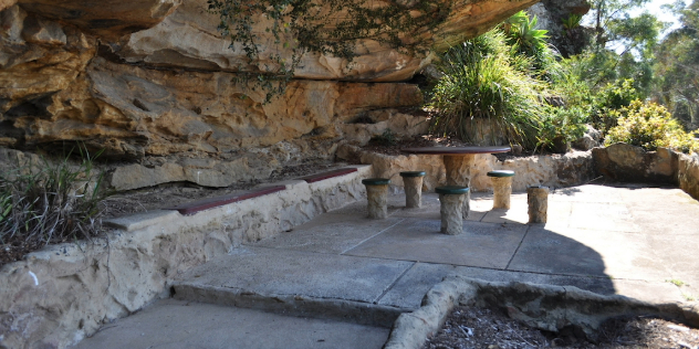
The hillside from which someone snapped the original Open Road photo is no longer accessible to the public and appears to be much more overgrown now. Avon’s lower section is dotted with remnants from the dam’s early days. Among the curiosities is what appears to be a trellised picnic area, with a tiered garden and water fountains long fallen into disuse. Pines and other conifers planted in upraised garden beds have survived, likely because they required no maintenance. Ornamental cobblestone pillars, inset with mosaics that form ‘Avon Dam’, bookend the entrance to a pathway that runs along the lake’s breadth.
Looking through the trees, a visitor can see white swirls of water filtration and we spot two high-vis-clad men in a tinny, most probably testing water quality. The path eventually reaches a dead end where, nearby, some old stairs climb to nowhere. Even more than the other two, Avon Dam cries out for some history to be posted on its pylons.
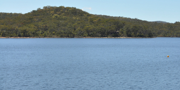
A dam good sight
What a difference a year makes. The two photos below show Cordeaux Dam at the height of the drought in September 2019, when it was at just 41 per cent capacity (left), and the same spot in November 2020, after a period of good rain had filled it to 87 per cent (right).;